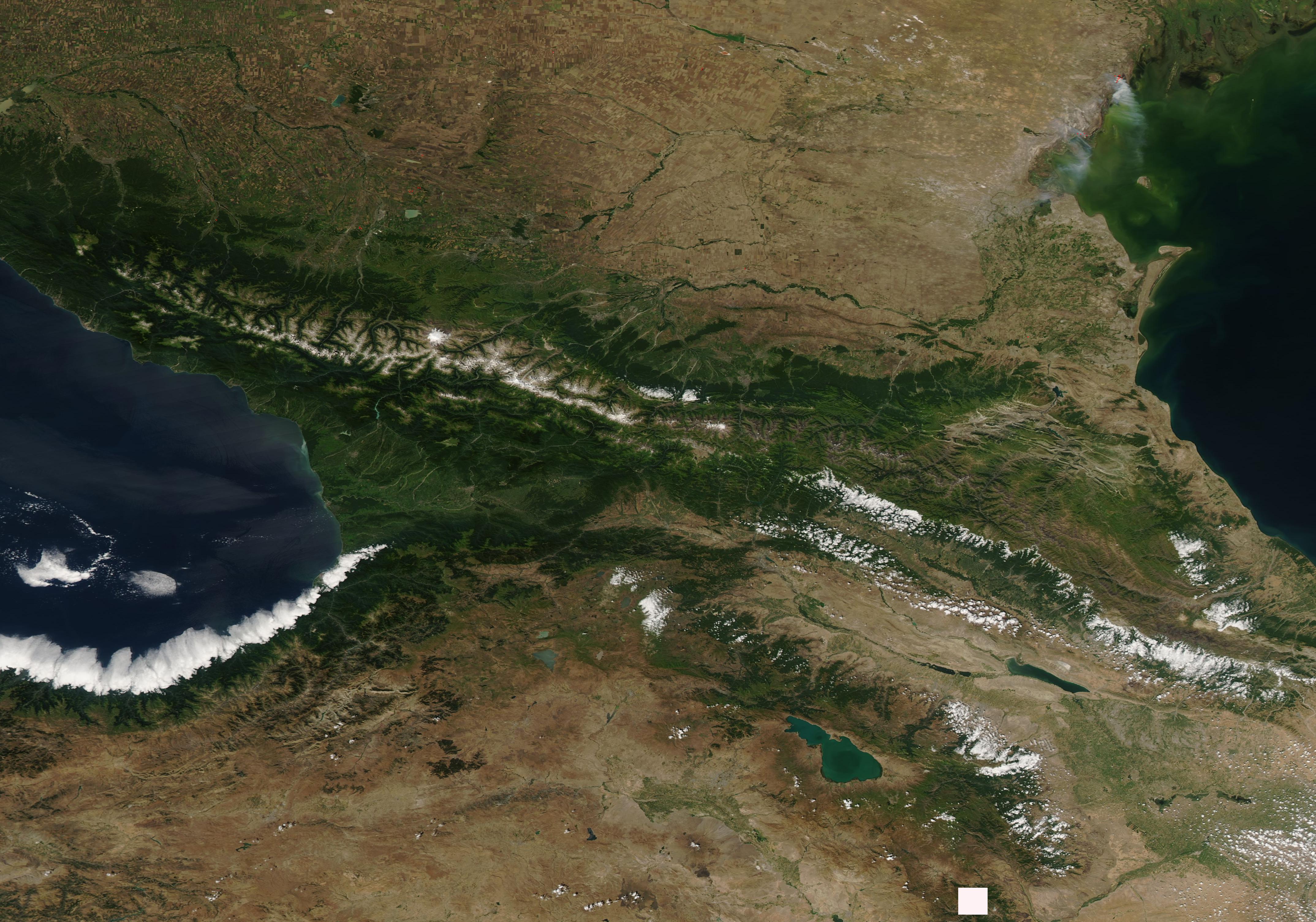
The Caucasus Mountains stretch between the Black Sea and Caspian Sea, and form a dividing line between southern Russia and northern Georgia and Azerbaijan. Even in late summer, snow caps the tallest peaks of the Caucasus. The highest peak in the range is glacier-covered Mt. Elbrus, which rises 18,510 feet (5,642 meters). Sitting in the middle of the range is the dormant Mt. Kazbek volcano.
Another mountain range, the Lesser Caucasus, extends southeastward from Georgia into Armenia, and snow also sits on the highest peaks. At the bottom of the southern slope of the Lesser Caucasus sits Lake Sevan, Armenia. A bright white bank of low cloud (fog) sits over the Black Sea, hugging the coast of Turkey.
The Moderate Resolution Imaging Spectroradiometer (MODIS) on board NASA?s Aqua satellite acquired a true-color image of a summer day in the Caucasus Mountains on August 14, 2019.
Image Facts
Satellite:
Aqua
Date Acquired: 8/14/2019
Bands Used: 1,4,3
Image Credit:
MODIS Land Rapid Response Team, NASA GSFC
 Front Page