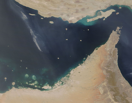
Dust filled the skies over southern Iran and northern United Arab Emirates (UAE) in early June 2018. The Moderate Resolution Imaging Spectroradiometer (MODIS) aboard NASA's Terra satellite acquired a true-color image of the region on June 10.
The arid lands of Iran sit in the north and the UAE in the south of this image. They are separated by the Persian Gulf (west), the Strait of Hormuz, and the Gulf of Oman (east). The northernmost tip of Oman, lying north of UAE on the Strait of Hormuz, is also visible.
Just off the coast of Iran is Qeshm Island - the largest of the Persian's Gulf numerous islands. It is 100 kilometers (62 mi) long. Between Qeshm Island and the mainland lies Hara Biosphere Reserve - the largest stretch of mangrove forest along the Persian Gulf shoreline. This forest is a hub of biodiversity in an otherwise arid landscape, attracting a large number of migrating birds as well as sea turtles.
Image Facts
Satellite:
Terra
Date Acquired: 6/10/2018
Resolutions:
1km (143.3 KB), 500m (322.1 KB), 250m (193 KB)
Bands Used: 1,4,3
Image Credit:
Jeff Schmaltz, MODIS Land Rapid Response Team, NASA GSFC
 Front Page

