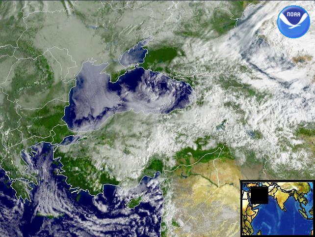
Data Elements: Rain and snow showers continuing to move over parts of the Mediterranean Sea and the Black Sea.
Observation Device: DMSP F-14 2.7 km visible imagery.
Visualization Date: February 27, 2003 09:24:04
Source: NOAA Environmental Visualization Program
 Front Page Front Page
| 