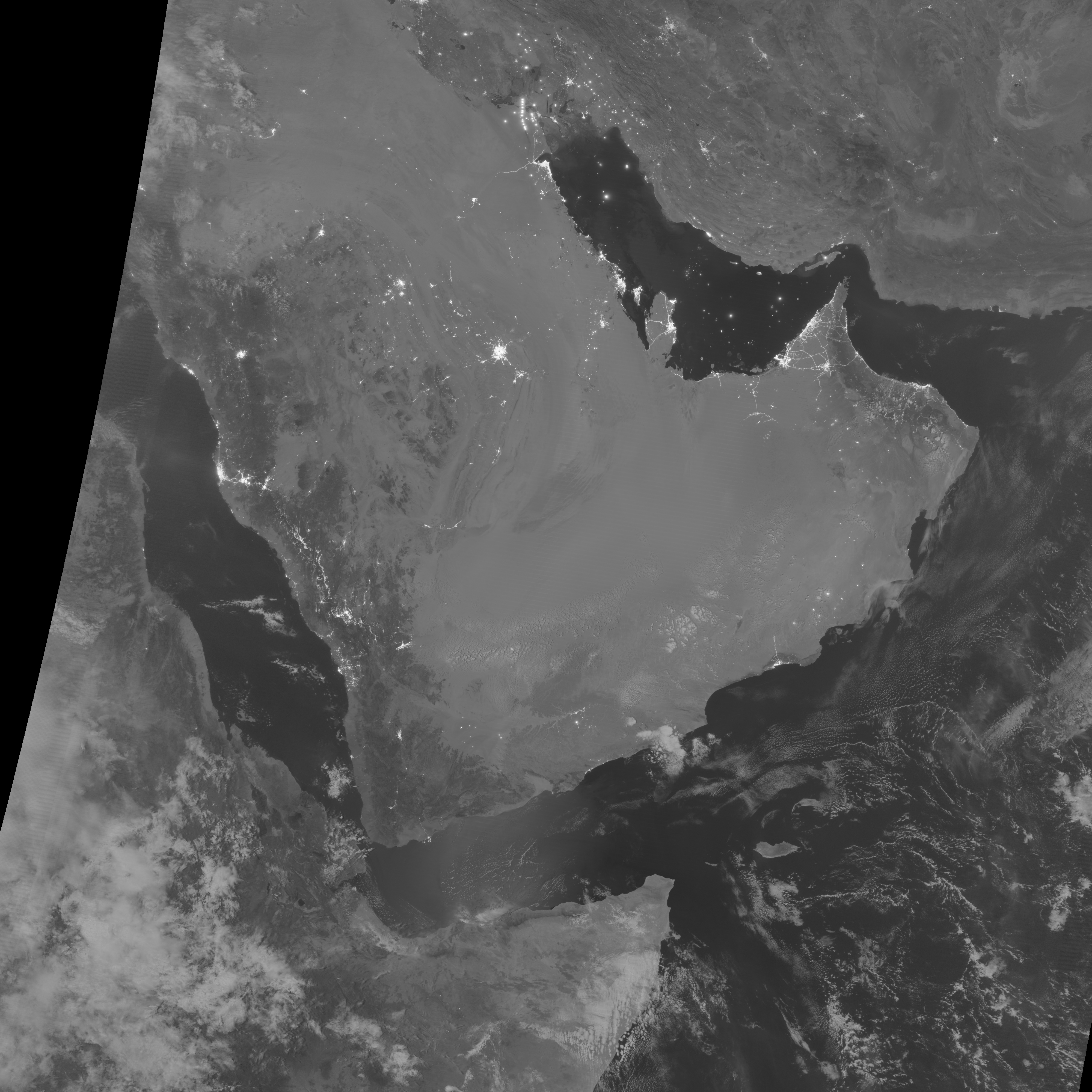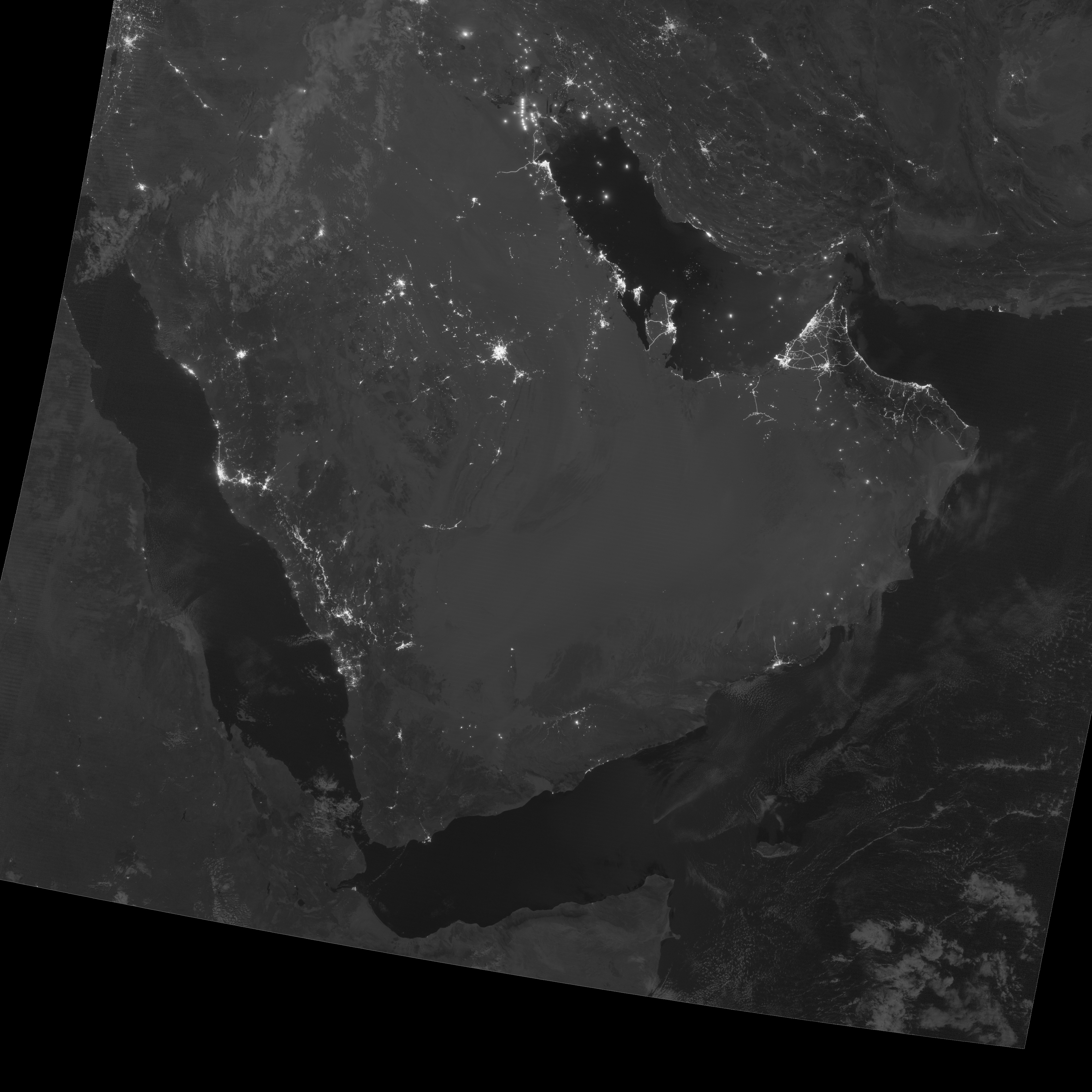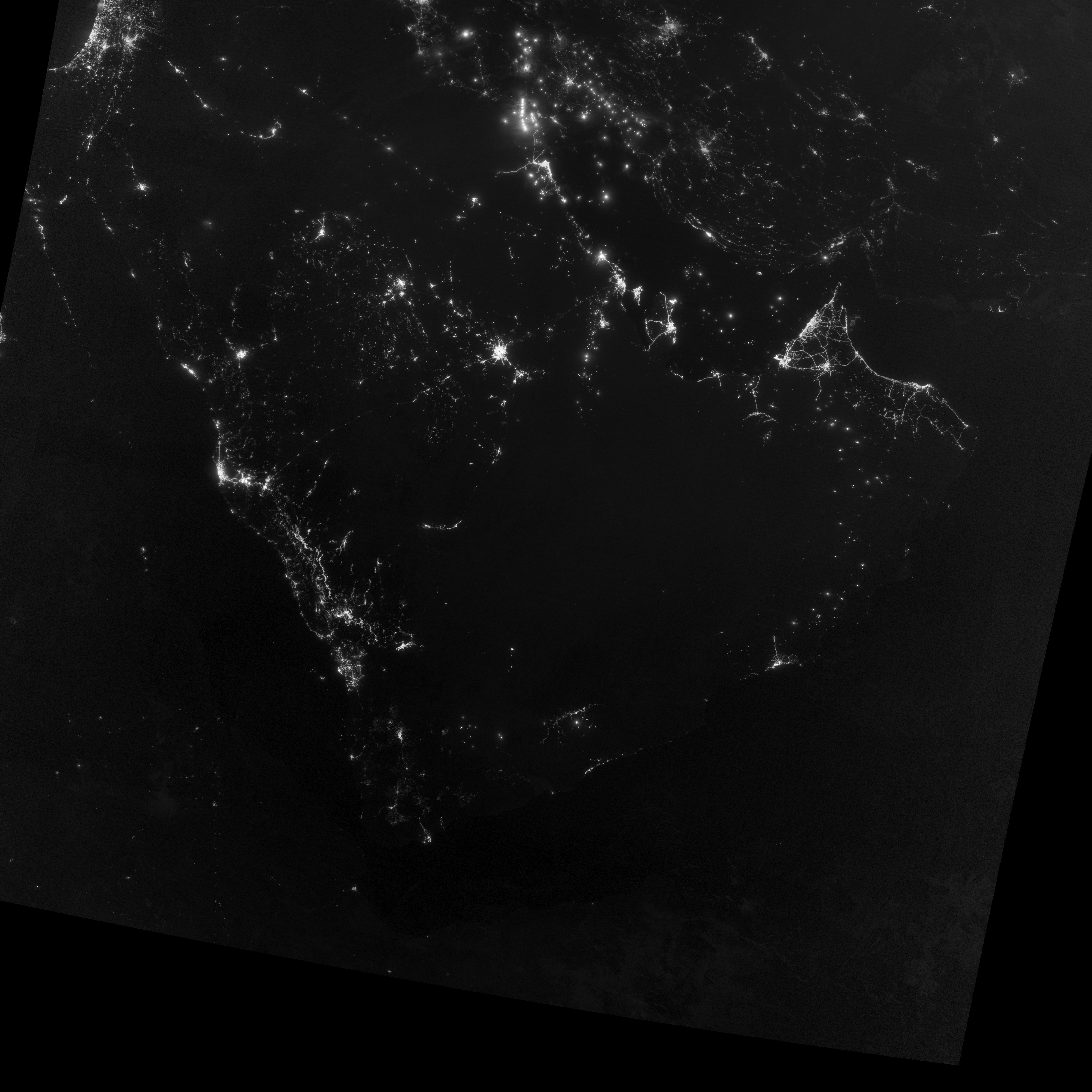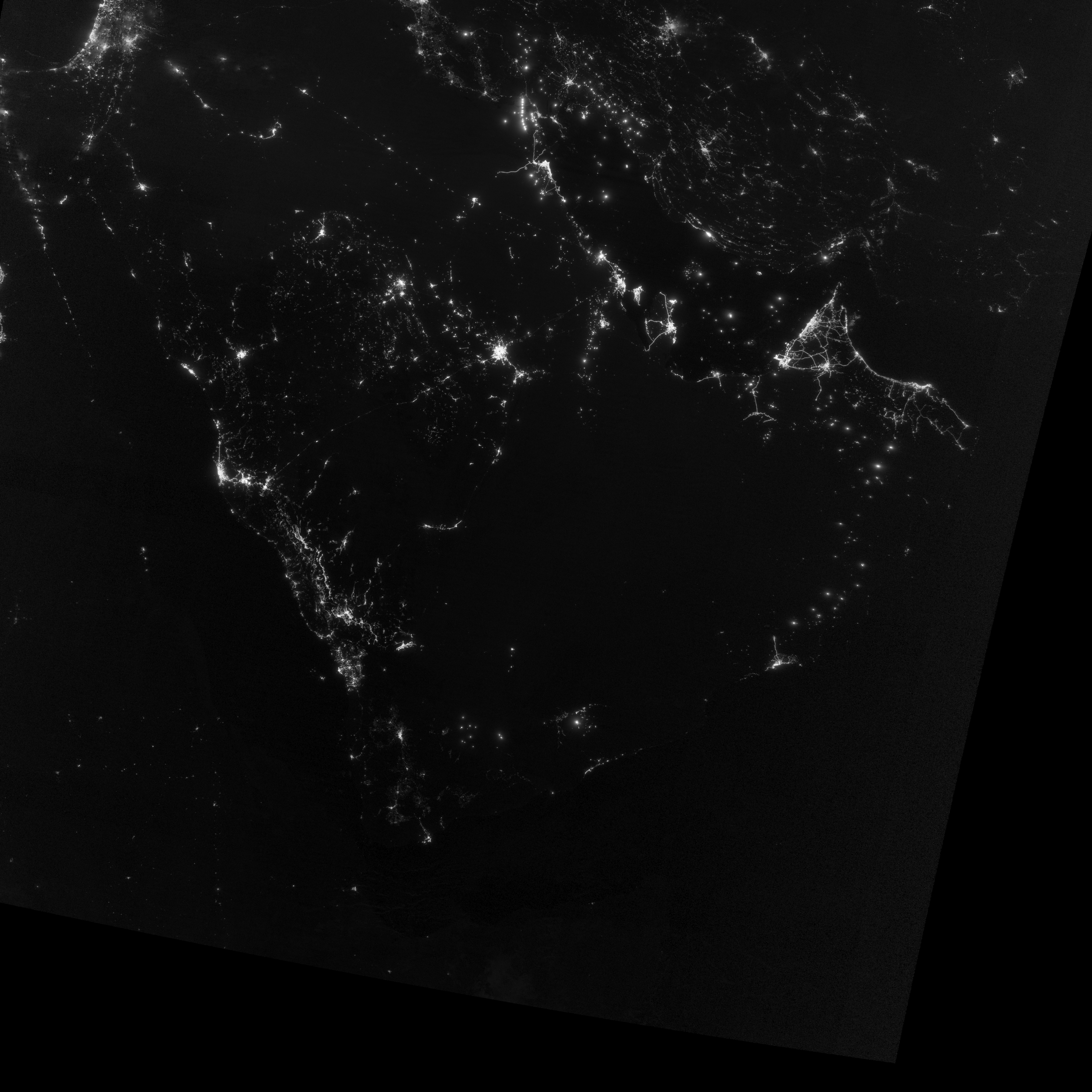
The Visible Infrared Imaging Radiometer Suite (VIIRS) on the Suomi NPP satellite captured these nighttime views of the Persian Gulf region on September 30, October 5, October 10, and October 15, 2012. The images are from the VIIRS “day-night band,” which detects light in a range of wavelengths from green to near-infrared and uses filtering techniques to observe signals such as gas flares, auroras, wildfires, city lights, and reflected moonlight. Each image includes an inset of the Moon in four different phases. September 30 shows the Persian Gulf by the light of the full Moon; October 15 shows the effects of a new Moon. As the amount of moonlight decreases, some land surface features become harder to detect, but the lights from cities and ships become more obvious. Urbanization is most apparent along the northeastern coast of Saudi Arabia, in Qatar, and in the United Arab Emirates (UAE). In Qatar and UAE, major highways can even be discerned by nighttime lights. In eighteenth-century England, a small group of entrepreneurs, inventors and free thinkers—James Watt and Charles Darwin’s grandfathers among them—started a club. They named it the Lunar Society, and the “lunaticks” scheduled their dinner meetings on evenings of the full Moon. The timing wasn’t based on any kind of superstition, it was based on practicality. In the days before electricity, seeing one’s way home after dark was far easier by the light of a full Moon. In the early twenty-first century, electricity has banished the need for such careful scheduling, but the light of the full Moon still makes a difference.
NASA Earth Observatory image by Jesse Allen and Robert Simmon, using VIIRS day-night band data from the Suomi National Polar-orbiting Partnership. Suomi NPP is the result of a partnership between NASA, the National Oceanic and Atmospheric Administration, and the Department of Defense. Caption by Michon Scott. |