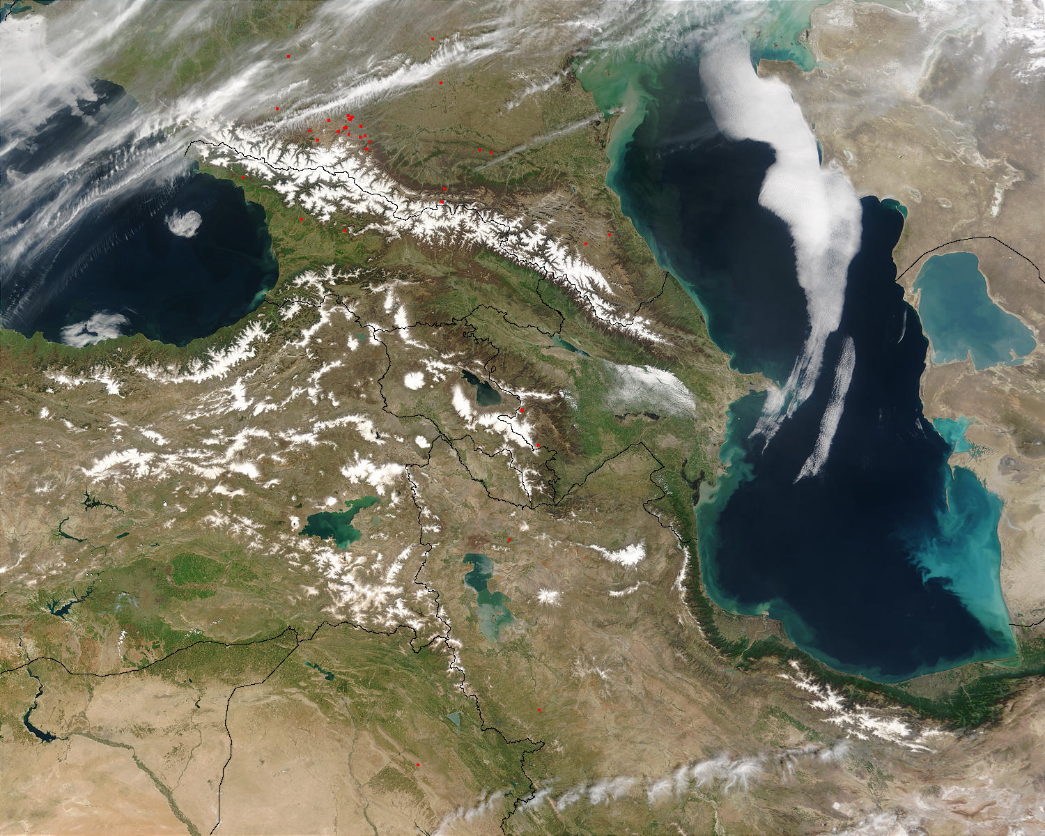
Between the Black Sea to the west and the Caspain Sea to the east, the Caucasus Mountains form a physical and cultural divide between southern Russia (top) and the Middle East (Iran at bottom right; Iraq, bottom center; Syria, bottom left; and Turkey, north of Syria). This region, sometimes referred to as the Caucasus Isthmus, has been in the path of successive Eurasian migrations over centuries. As those travelers mixed with the inhabitants and settled in pockets in the rugged, mountainous terrain, the geographic isolation created and preserved numerous small, diverse ethnic groups. Indeed, this region is one of the most ethnically diverse in the world; more different languages are spoken here than any other similarly sized region in the world!
The dominant geographic feature in the region is Mt. Ararat, also known as Agri Dagi. The peak of Ararat, a large that last erupted in 1840 according to historical records, is located approximately 40 kilometers (25 miles) to the south of the Armenia-Turkey border. A lower peak to the east, known as Lesser or Little Ararat, is also volcanic in origin. Dark gray lava flows to the south of Mt. Ararat are located near the Turkish border with Iran. While this border is also closed along much of its length, official crossing points allow relatively easy travel between the two countries.
This Moderate Resolution Imaging Spectroradiometer (MODIS) image from May 5, 2003, shows the snow-covered Caucasus Mountains separating southern Russia from Georgia (southwest) and Azerbaijan (southeast). West of Azerbaijan is Armenia. At the foothills of the Caucasus, a few scattered fires were detected and are marked with red dots. These fires are probably agricultural in purpose, set by humans to prepare farm or grazing land for spring time activities.
 Front Page Front Page
|