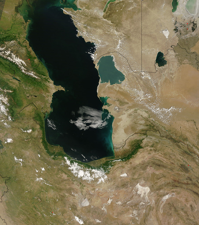

The Caspian Sea | Satellite: Terra 1km | 500m | 250m |
This image, captured by the MODIS on the Terra satellite was captured on May 21, 2007. It shows the Caspian Sea, a large, landlocked, saltwater body of water. It is considered the largest on Earth, by area. At the edges of it, swirling clouds of greenish sediment and phytoplankton are visble. The Caspian sea has no natural outflows, and is supplied with water from the Ural and Volga rivers. Since evaporation is the only way in which it loses water, the level of the sea rises and falls independently of the rest of the world's oceans and other water bodies. The Caspian is renowned for rich natural resources, namely sturgeon, oil, and natural gas. Because five nations share its waters - Russia, Azerbaijan, Iran, Turkmenistan, and Kazakhstan - the competition for these resources is fierce. In the top right corner of the image, the bottom half of the Aral Sea is just visible. The red dots are locations of active fires in the region. Black lines denote country borders. Source: MODIS Land Rapid Response Team, NASA Goddard Space Flight Center.  Front Page Front Page |